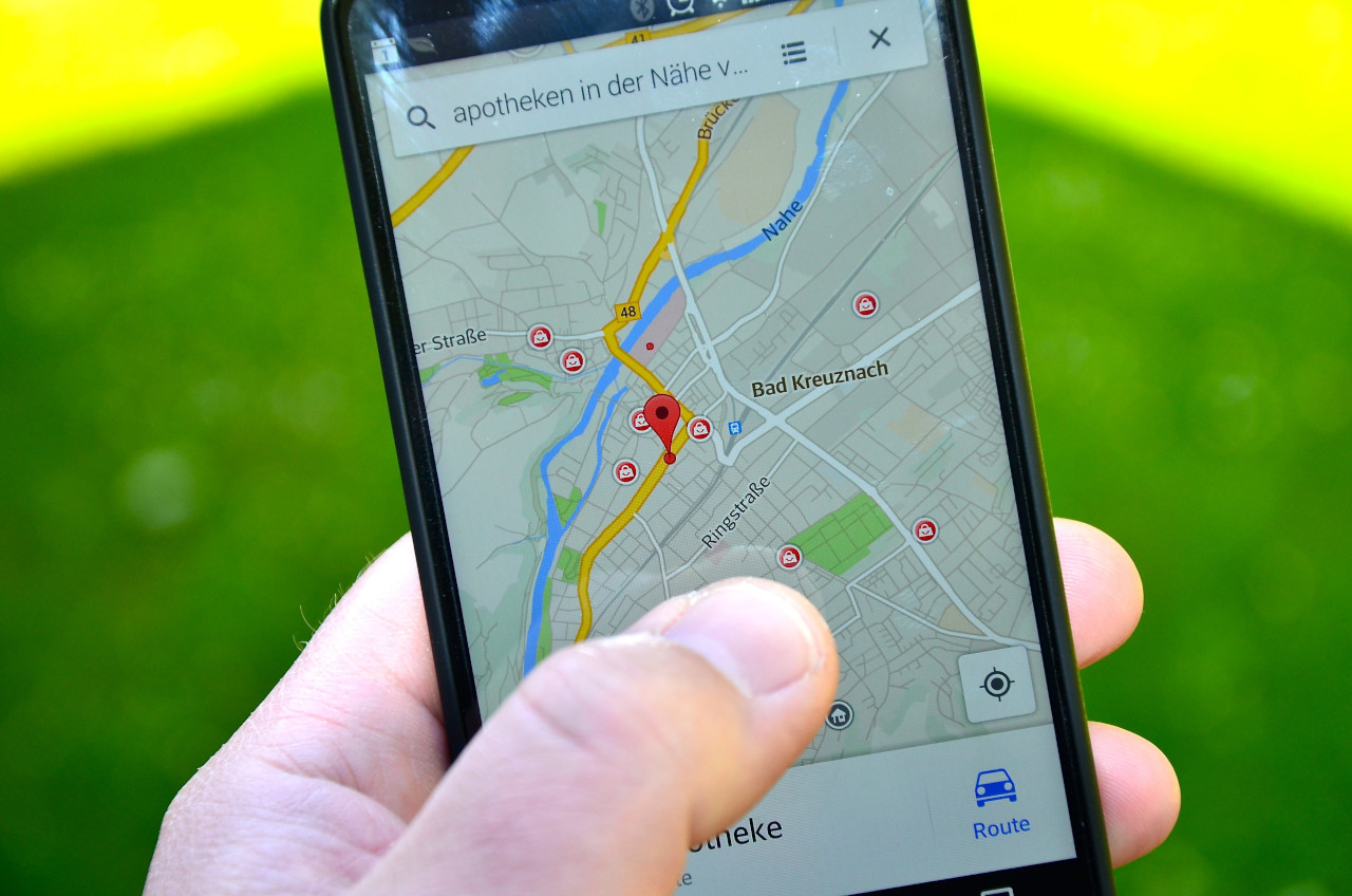
Researchers at the Norwegian University of Science and Technology have developed SmartNav, a positioning system that achieves better than 10 centimetres accuracy 90 per cent of the time in urban environments where regular GPS often fails, potentially revolutionising autonomous vehicle navigation and consumer GPS devices.
Ardeshir Mohamadi, a doctoral student at NTNU, led the development of a system designed to overcome urban canyon effects, where glass and concrete cause satellite signals to bounce between buildings, creating positioning errors. The technology combines carrier phase positioning, PPP-RTK corrections and Google’s 3D building maps to deliver precision approaching that of expensive professional systems whilst using affordable consumer-grade receivers.
Traditional GPS struggles in cities because signals reflect between buildings and take longer to reach receivers, causing incorrect distance calculations to satellites. Mohamadi said: “Cities are brutal for satellite navigation. In cities, glass and concrete make satellite signals bounce back and forth. Tall buildings block the view, and what works perfectly on an open motorway is not so good when you enter a built-up area.”
The system addresses a critical requirement for autonomous vehicles operating in urban areas. Mohamadi said: “For autonomous vehicles, this makes the difference between confident, safe behaviour and hesitant, unreliable driving. That is why we developed SmartNav, a type of positioning technology designed for ‘urban canyons’.”
Signals corrupted by reflections
SmartNav abandons traditional GPS code signals that become corrupted by reflections, instead using the carrier phase of radio waves transmitted by satellites. Whilst carrier phase positioning can provide very high accuracy, it typically requires receivers to remain stationary for several minutes, making it impractical for moving vehicles.
The NTNU team solved this limitation by integrating multiple correction technologies. The system uses PPP-RTK, which combines precise corrections with satellite signals, now broadcast free by the European Galileo system. The researchers then incorporated Google’s 3D building models covering almost 4,000 cities worldwide.
Google launched its service for Android customers to predict how satellite signals reflect between buildings using 3D maps. Mohamadi explained: “They combine data from sensors, Wi-Fi, mobile networks and 3D building models to produce smooth position estimates that can withstand errors caused by reflections.”
The researchers combined these correction systems with proprietary algorithms and tested the technology in Trondheim streets, achieving better than 10 centimetres accuracy 90 per cent of the time. Traditional GPS receivers typically achieve accuracy of several metres in urban environments, while professional RTK systems, which require expensive base station networks, can achieve centimetre-level precision.
The breakthrough makes high-precision positioning accessible to mass-market devices, including mobile phones and fitness watches, without requiring costly subscription services. Mohamadi said: “PPP-RTK reduces the need for dense networks of local base stations and expensive subscriptions, enabling cheap, large-scale implementation on mass-market receivers.”
The technology can be integrated into autonomous vehicle navigation systems as software, eliminating the need for expensive additional hardware. The system processes satellite signals in real-time, determining which signals are corrupted by reflections and applying appropriate corrections based on 3D building data and multiple correction sources.
RTK positioning requires two units: a base station at a fixed position collecting satellite data and a mobile unit using this data with its GPS receiver to determine precise position in real-time. This method is currently used in surveying, construction, agriculture and land management but remains expensive for consumer applications.
PPP-RTK combines PPP’s global coverage with RTK’s fast convergence and high accuracy by using both global corrections and regional real-time data from reference stations. The European Galileo system now supports this approach by broadcasting corrections free of charge, making it accessible for consumer devices.